
Publication Date
2020
Document Type
Poster
Description
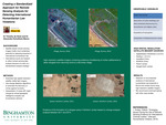
Technological advancements have given way to satellite-arrays capable of producing high-resolution imagery from outer space. Accordingly, there has been much controversy surrounding the use of satellite imagery in forensics in detecting international humanitarian law violations because of the absence of a standardized analysis strategy. As a result of this, international courts remain hesitant to utilize such imagery analysis for evidence to corroborate decisions. This work aims to explore an approach for conducting satellite-array imagery analysis to detect humanitarian law violations that may be standardized for future forensic use. The investigation focuses primarily on case studies of various conflict-torn regions, including Syria, Sudan, and Rohingya. Imagery from Planet Lab's micro-satellite array was used to conduct change-analysis of the region from before and after the ordered withdrawal to track the trajectory of pertinent objects, local destruction, and regional activities to detect infractions. The methodology presented in this work may be applied in future attempts at detecting humanitarian law breaches beyond aforementioned regions. We recommend that such tactics should be repeatedly tested for their potential to create a universally accepted standard for forensic use.
Files
Download Full Text (1.4 MB)
Recommended Citation
Wu, Allie, "Creating a Standardized Approach for Satellite-Based Remote Sensing Analysis for Detecting International Humanitarian Law Violations" (2020). Research Days Posters 2020. 96.
https://orb.binghamton.edu/research_days_posters_spring2020/96